Showing posts with label ares. Show all posts

12 June 2025

ARES Southeastern US Situational Awareness Map Updates - 12 June 2025

Before diving in to the discussion about changes, I think I'm going to start using this blog as the notification outlet for the Situational Awareness Map. Normally when I do updates and I need to get word out about key changes, I'm cross-posting between a couple of Facebook and Groups.io sites. It gets clumsy, and I have to keep my comments short to fit the various platform restrictions. Using this blog allows me to be a bit more 'expansive' in my comments and discussions about changes.

Now, on with the show!

Yesterday I pushed out a few key changes to the map that wrap up some content updates and a few minor layout changes. Let's have a look.

Since the 2025 Hurricane Season opened on 01 June. I set the NOAA Active Hurricanes layer to on by default. This means any NOAA-released hurricane & tropical storm information (tracks, probability polygons, etc.) will automatically appear and update as NOAA releases information. This layer will stay on by default all the way through hurricane season


Under the Situational Awareness layer group, I added a Current Wildfires layer. This data is hosted by the Department of the Interior, and provides basic information on current wildfires across the US. This layer is off by default:


Let's spend a moment discussing repeaters. After a few years of hosting Repeaterbook.com info in the map, and getting very little feedback on Georgia repeaters (good or bad) - and zero info on repeater data from other states - I've decided to take a different approach. I've dropped the Repeaterbook.com coverage, and have gone back to an internally managed repeater database for just Georgia. This new data can be found in the Georgia Amateur Radio Repeaters layer. What you see in the map today is a slight update to the old Georgia Repeater Database Initiative information. I can take direct updates to repeater information, and can make quick changes - new repeaters, off-line repeaters, changes in repeater location, etc. I will likely put up an on-line form to capture this info, and link it in the map, but that's still a few weeks off. I'm also using a data clustering display tool, which is why you see a bunch of large dots when you turn the layer on. As you zoom into the map, the repeater data will 'dis-aggregate', and  you'll be able to get all the way down to individual repeaters. This layer is turned off by default:


Next up... PSAP boundaries. This one caused a slight stir a few months ago when I put out the word that the Dept. of Homeland Security pulled down the national PSAP (Public Service Answering Point) boundaries layer, and I had to take the layer out of the map. Not that anyone actually used the boundary info, they were just incensed that DHS took it down. Conspiracies, and all that. Folks, it happens all the time with this cooperative mapping platform, not just with national level datasets, but with very innocuous local datasets like local bird sightings, or community-level Girl Scout Cookie sales point layer (yes, someone made a cookie sales point map layer). I do it in my regular job as a GIS program manager at a very busy international airport. Data layers often age-out, security restrictions get imposed, or we just come up with new ways to display the data. So we pull down the old and (usually) put up something new. It's not just me and the DHS doing it - NOAA does it, the Georgia Emergency Management Agency does it, local governments do it, DOT does it, FEMA does it - everyone does it. The real issue is that there's no built-in notification system that lets map authors know a data layer is no longer available. The map just throws an error when you try to open it and a data layer is no longer available. So, back to PSAP data. Yesterday I discovered that the State of Georgia has published its own PSAP data layer, and I've added it into the map. You'll find it under the Borders, Operational Boundaries & Geographic Features - Georgia layer grouping. This layer is turned off by default:


Let's wrap this up. The last thing I want to talk about is finding layers in the map. There are over 50 individual data layers in the map, and the layer structure is complex. It can be tough finding the exact layer you want to take a look at. Heck, even I get lost in the layer stack! That's why I've incorporated a search tool in the Data Layers window, to help you find what you are looking for. It's the little search icon in the upper right corner of the window:


Let's say you are searching for a layer that shows lakes in Georgia. You heard the layer is in the map, but you don't know where. Just open the search tool and enter 'lakes'. The search tool will find the layer group that 'lakes' is nested up under. Simply expand the layer grouping to find the Georgia Lakes & Ponds layer and click the check box to turn it on in the map (it's normally off by default):


That's it for this update. As always, if you have any questions, feedback, or would like some instruction on how to use this map just let me know. There is a feedback button in the map, and it's the best way to get my attention.


W8BYH out

16 February 2025

Hubris

I got complacent and sloppy yesterday, and I'm still recovering.

My local ARES group, Fayette County ARES, along with the local ham radio club, KK4GQ.org, routinely supports races, triathlons and other charity or public service events in the county. Yesterday was the annual Southern Conservation Trust Run The Ridge 5k & 10k race. I've helped with this race for years, even served as the communications coordinator a time or two. But yesterday I was just a checkpoint monitor - stuck out by myself on a trail intersection to make sure runners keep heading in the right direction.

For a few days before the race the weather reports called for cold temps and a chance of rain, but I didn't pay attention. Since I've worked this race before, and since my house is only about a mile from this race (as the crow flies) I got cocky and complacent. I packed either the wrong stuff, or the bare minimum of the right stuff. 

I hit the race location around 0700. It was cold, misty and drizzling. I told my wife it reminded me of central Germany in the late fall. Not super cold, but always damp and drizzly enough to make the cold a bit more miserable. And for that, I was not properly prepared. My coat was not waterproof, my boots were not waterproof, my trousers were not heavy enough, I didn't have any rain gear, no plastic bags to put important items like the trail race map into. I didn't even bring a folding chair and had to borrow one. Didn't much matter, because I had no way to shield it from the rain when I wasn't sitting in it. A poncho would have been useful. Also, no hot beverages. I've got a closet shelf full of thermos bottles, but didn't think to fill just one of them with coffee. About the only thing I did right was bring along a waterproof HT (an Icom ID-52, which was better prepared for the weather than I was).

Like I said, I got cocky and complacent. Because of that I ended up standing in one spot for almost three hours, cold, wet and while not quite miserable, certainly uncomfortable.

Cold, wet, lonely and borderline miserable

Lessons learned. Next time pay more attention to the weather and the mission, and be the Boy Scout (Be Prepared). 

  • Thinsulate or Gore-Tex boots. I normally wear Merrell Moab hikers. I got cheap on my last purchase and opted for the non-waterproof version. I won't make that mistake again.
  • Rain gear. Just a simple set of inexpensive and lightweight Frogg-Toggs (jacket & over pants) would have worked great
  • Gloves, even just a thin pair of mechanic's gloves, would have worked great
  • Wide brim hat or cap to keep the water dripping from the trees off my head and neck
  • Flashlight. With the overcast weather and early race start, I ended up using my phone to illuminate the trail map and the deep recesses of my backpack
  • Collapsible chair that can be carried slung over the shoulder
  • Waterproof bags. Just gallon-sized zip-lock bags will suffice
  • Poncho or lightweight tarp to cover all the gear
  • Small thermos with coffee
  • Compass. Compass? Yes. I needed to orient the trail map to my location to make sure I was sending runners in the right direction. I used the compass app on my phone, but I hate relying on electronic devices in situations like this, and my phone is not weatherproof. A simple orienteering compass would have fit the bill nicely
This race was a painful and embarrassing reminder that I need to pay more attention to prepping for even the simplest events. What's even worse is that, except for the waterproof boots, I have all this stuff sitting stacked in my man cave. If I had given it half a thought I could have grabbed it all on the way out the door. But noooo, I'm too smart and experienced for that.

I guess it's good to know I still have room for improvement 😣

W8BYH out

12 November 2023

NVIS Exercise Wrap-Up

On 07 October, Georgia ARES and AUXCOMM conducted a state-level NVIS exercise. It was designed to test voice and digital comms between ARES groups around the state and the two Georgia Emergency Management Agency (GEMA) operations centers. GEMA runs one state operations center (SOC) at its headquarters in Atlanta and a back-up ops center in Forsyth, Georgia. As far as we know, this is the first time an exercise like this had ever been held. 

A few days ago I did the final wrap-up on the exercise by holding the on-line AAR briefing. You can view the presentation slides at this link, and view the AAR session here:

Overall the exercise was a success, and it helped us better identify some issues that I believe ARES and EMCOMM here in Georgia need to focus on.

Before going further, I need to remind all readers that this is my blog, and these are my observations and recommendations, and they do not represent any official Georgia ARES positions or recommendations.

  • Participation. For decades, Georgia has been struggling with low ARES and Amateur Radio participation in the largely rural southern and eastern parts of the state. Georgia is a big state - the biggest east of the Mississippi in terms of contiguous land area. Most of the population is concentrated in the Atlanta metro area, but that only consists of 14 counties out of a total of 159 (9%). Amateur Radio activities, participation and infrastructure in the Atlanta metro region, and all the way down the I-75 corridor to Macon, is strong. However, participation in any ARES activity from the areas east and south of the Atlanta - Macon line is weak. In fact, the region below a curved line running from Augusta to Columbus is known as the 'silent crescent' (the shaded area in the map below). ARES and Amateur Radio have very poor representation in this region - it's just hard to find the people to participate in activities like this exercise. Yet, it's these counties that end up needing disaster recovery and communications support the most. They are square in the target area for spring and summer storms pushing into the state from the west, and any hurricane or tropical storm pushing up from the Gulf of Mexico or Atlantic coast hits these counties hardest. It's accurate to say that tropical storms coming up from the Gulf vent their fury as dying hurricanes in these southern counties before wandering north towards Atlanta as little more than moderate rain and wind events. 
There is no easy fix for this lack of participation. It's due to a combination of factors - mostly rural areas with low population densities and lower income levels certainly has a lot to do with it. I don't have a solution to this problem, but it is something ARES needs to work on going forward. 
 
The 'silent crescent' encompasses all counties south of the Augusta - Columbus line

  • Digital vs. voice. Honestly, I didn't anticipate this being as big an issue as it turned out to be, but two separate issues quickly coalesced to bring the digital vs. voice issue to the forefront. As we planned this exercise we knew we wanted to have a digital portion to see if participating stations found a difference in their ability to connect to the SOCs on voice and digital. Although Georgia ARES runs regular digital nets on PSK-125 and MT-63, most folks show up for just the voice nets. The digital portion of this exercise was just supposed to be a confidence builder - a quick check-in with the SOCs to confirm that their digital setups work. But a lot of stations, including the SOC at GEMA HQ in Atlanta, struggled with properly running Fldigi. In general, many participants struggled with digital operations - less than 2/3 of the stations that made successful voice contacts on 80, 60 & 40 meters made successful contacts on digital. This doesn't mean digital doesn't work, it means we need to pick a better mode (we used PSK-31) and improve the digital operations experience base for all of Georgia ARES.

Early in the planning process we identified the need for a simple back-channel chat tool that would allow the SOCs and participating stations to coordinate activity without interrupting the exercise operations. This chat tool became more important than we anticipated, as poor operating conditions had us moving band-to-band to find a usable frequency. The tool we picked, like all the tools we looked at, was web based. This meant everyone using it had to be on the internet. However, one of the goals of the exercise was to simulate a cyber-denied scenario - no internet at all. In this scenario all of the chat tools we're familiar with - Slack, Telegram, FB chat, Discord, Groups.io, etc. would not be available. The need for a chat tool doesn't go away, just the ability to use it. It's precisely this scenario where several good point-to-point HF communications tools pop up, and are all digital - Fldigi running MT-63 (already an adopted Georgia ARES standard), JS8Call and VarAC (Vara Chat). All of these tools have the capability to fill the one-to-one or one-to-many operator chat and coordination tool role.

Digital operations offer huge advantages over voice. MT-63 running in Fldigi and JS8Call offer great weak signal performance, particularly JS8Call, which is based on a modification of the FT8 protocol. JS8Call can decode traffic when it can't even be seen on the spectrum waterfall. VarAC uses Vara as the soundcard transport mode, and Vara is world famous for it's ability to hold a connection through rough band conditions. If a connection is lost, VarAC can be configured to automatically try to re-establish the connection. It's tenacious. This all means that digital modes offer more reliable and overall faster traffic throughput than voice communications. These tools can also run in unattended mode, pass small messages, and in the case of JS8Call and VarAC, can handle automated band and frequency changes based on time of day. They can also stage and pass traffic through intermediate stations using a 'traffic parking' function. In short, these software packages can be configured to automate a lot of the functions that an ARES operator would normally do manually. Again, reduced error, improved throughput and reduced operator workload.

What about Winlink? Nothing I propose here impacts Winlink; it remains the primary tool for passing email, ICS traffic and small files. It's the heavy-weight tool that will handle most of the formal traffic. What's proposed here is an adjunct tool that sits side-by-side with Winlink and handles those real-time coordination tasks

Pulling this all together, I believe the future of  HF-based emergency communications support lies in digital, not voice. If we're serious about providing robust communications that actually fill a need, it'll have to be more than a bunch of guys and gals talking into microphones. The great news is that we've got excellent digital tools that were not available to us just five years ago. It's time to leverage them. Let's flip the paradigm and make digital comms the primary standard in Georgia ARES, voice the secondary. Then pick a tool, but just one tool! Build a state-level communications architecture around it; installation packages, documentation, configuration files, even a virtual help desk, and train hard against real world scenarios.   


Not to toot my own horn, but heck, why not. I wrote about this issue back in 2020 in a series titled The EMCOMM Layer Cake. If anything, our software options have improved since then. Winlink's gotten better, JS8Call's gotten better, VarAC has hit the streets. Even Fldigi has seen improvements. The emergence of Vara as an unofficial standard that rivals Pactor in speed and connection reliability has had a huge impact on Winlink operations. I expect to see other applications, similar to VarAC, build out dependencies on Vara to take advantage of its excellent connection properties. If you are involved in emergency communications at any level and haven't bought a Vara license yet, I would just go ahead and do it; it's almost inevitable that having one will be a requirement in the near future. 

  • NVIS. This was billed as an NVIS exercise, so did NVIS work? As I emphasized in the run up to the exercise, it's not about how far you can talk, but how close you can talk on 40, 60 & 80 meters. We all know we can talk from Dalton to Kings Bay (about 350 miles) with no problem on our 80 and 40 meter dipoles, but can we talk from the State Operations Center in southeast Atlanta to the EOC in Fayette County (about 20 miles) on 40 or 80 meters? That was the challenge the exercise posed. Although I don't have hard numbers, I can say based on our experience at the Atlanta SOC at GEMA HQ the answer is yes. The antenna we used was the Chameleon CHA-NVIS, a modification of the US Army's AS-2259/GR NVIS antenna. We got excellent signal reports from most counties in the immediate metro Atlanta area on 40 meters. Was it the antenna? Was it just good 40 meter propagation? We can't tell for sure, but based on my limited use of this antenna for other NVIS work I have to say that this particular antenna configuration offers excellent NVIS performance.

That wraps it up for this exercise overview. If you have any questions or comments you can add them below in the comments section, or contact me directly at w8byh@arrl.net. Thanks!

W8BYH out

09 October 2022

Vara Chat

For the past month I've been playing around with and learning a new-to-me HF chat application called VarAC (or Vara Chat). I first heard about VarAC earlier this year, but was wrapped up in other radio things and didn't pay it any attention. Then several weeks weeks ago I caught a discussion thread on the Vara Groups.io site focusing on VarAC, and I became interested enough to give it a try.

What is VarAC? VarAC is an HF chat application developed by Irad Deutsch, 4Z1AC. VarAC uses Vara as the communications protocol, so it 'sits' on top of Vara and takes full advantage of Vara's robust connection reliability and speed capabilities. VarAC competes in the same ham radio application space as JS8CALL, an application I've written about in the past. When JS8CALL came out about 3 years ago I was impressed. Finally, an HF digital chat mode that was robust, professionally developed and offered excellent functionality. Plus for the huge existing base of FT8 (WSJTX) fans, learning the new application was a cake-walk since it's the JS8 protocol is based on FT8. I pushed hard (with only limited success) to have JS8CALL adopted as a communications standard within our local and state ARES organizations.

And then along comes VarAC. VarAC and JS8CALL share a lot of functionality. They're designed to do the same thing - live keyboard-to-keyboard chat on HF - so you'd expect that they share many of the same features. The differences in functionality are a reflection of the transport protocols (JS8CALL vs. Vara) and each developer's vision for their own product. Both applications are equally good in within their own design and implementation envelopes.

The W8BYH Venn diagram of JS8CALL & VarAC features

VarAC includes a few neat features that JS8CALL lacks. Perhaps the biggest one is the ability to transfer files and images, something JS8CALL can't do (...yet?). VarAC's transport mode is also interesting. It's a very tight P2P connection, established and maintained by Vara. It's as though Vara sets up a VPN-like tunnel between the communicating stations, and makes sure all message traffic is heard on both ends 100% error free. To do this, VarAC selects a frequency 'slot' or channel for each P2P session, and holds that slot until communications are complete and either party formally ends the session. VarAC is also very good at attempting to re-establish connections if something inadvertently happens to break the connection, like band conditions changing drastically in the middle of a QSO.

Is VarAC a better EMCOMM tool than JS8CALL? I can't say. JS8CALL does offer a few features that make it a compelling choice - the ability to do group calls and the ability to use third party JS8CLL stations to store and forward message traffic. But the VarAC developers have just announced that the upcoming release (within a few weeks of this post) will include the first version of 'store and forward' capability.

I'll be doing a more in-depth comparison of JS8CALL and VarAC in the future. But for right now your homework assignment is to go out and install and configure VarAC and make some contacts!

W8BYH out

20 September 2022

Deja-vu All Over Again

Or should this be titled Groundhog Day?

Hurricane Fiona tracked just offshore of Puerto Rico on Sunday, and wiped out virtually all power on the island and severely damaged other infrastructure. This is almost five years to the day that Hurricane Maria did her best to wipe Puerto Rico completely off the map.


There's a question and an observation here. First the question. Post Maria, the federal government pumped billions of dollars into Puerto Rico to help rebuild and harden the infrastructure. My question now is, what failed, and why? What did those billions buy? It certainly doesn't look like it bought any effective infrastructure improvements. I can understand some of the island going dark, or even a lot of the island going dark, but to have the entire island go dark should be raising red flags regarding infrastructure investment and how the money was spent. My suspicion is that, given the current political climate, those questions will remain unasked.

Now the observation. I've said this repeatedly, I don't care how good your infrastructure is, Mother Nature will have her way. Think about it - the entire island is without power. No phone, no internet, no lights, no clean water, nothing. Yesterday you were watching Game of Thrones and surfing the internet, today you're trying to figure out if your relatives in the village on the other side of the ridgeline are still alive. A total service outage can, and at some point will, happen. 

Are you ready?

W8BYH out

10 July 2022

ARES Southeastern US Situational Awareness Map

This is a bit of a coming out party. So, noisemakers and party hats all around!

Last month I put up a post about the Situational Awareness Map, highlighting some changes I had made, and some future plans. Well I'm happy to announce that the map is now out of beta development and is available for general use. A lot of the changes are evolutionary, not revolutionary. But the changes and improvements are significant enough that a quick overview is warranted.

Perhaps the biggest change is that the map is now focused on the entire southeastern US, not just Georgia. I've talked with key users of this map for some time and the thought is that a regional focus makes more sense; weather systems and radio signals don't respect political boundaries, and we are often called on to support our fellow ARES members in adjacent states. But how do we define 'southeastern US'? Well, the most logical way is to follow FEMA, and use FEMA Region 4 as the definition. This makes a lot of sense since organizations like SHARES, DHS, CISA, NOAA, the Army Corps of Engineers and other federal agencies structure their disaster response frameworks in relation to FEMA regions. So FEMA Region 4 it is!

Other key improvements come in how the map (data) layers are structured in the map. Data structure is tightly focused around individual states. This give each state the ability to focus/display only the data pertinent to their states. There is a lot of regional/national data in the map, but that's only for map layers that by design must span the region. The best example is NOAA weather radar. This is a national-level data feed and it is impossible to segregate it out by state.

Another serious issue that is starting to push to the forefront is map performance. At this time there are over 45 separate data layers in the map, everything from severe thunderstorm warning polygons to PSAP 911 service areas. Every data layer, even if it's turned off, imposes a performance penalty in the map. Let's use the HIFLD fire/EMS station dataset as an example. This is a national-level dataset with tens of thousands of point (station locations). Before the map can display just fire stations in state of Florida it must first pull across the entire dataset, apply a dynamic filter against the data to select just fire stations that fall inside of Florida, apply a complex symbology rule against those points and then dynamically display them in the map so the fire station symbols remain the same size regardless of the zoom level the user selects. That's a lot of work to ask a web browser to handle. Multiply this one example by 45 or so data layers and you start to understand why map performance is an issue that must be carefully managed. This map is starting to push the performance limits of what Chrome, Firefox and Edge can reasonably handle. For that reason I've imposed some rules that users need to be aware of:

  • With the exception of the Severe Thunderstorm Warning and Tornado Warning polygons (provided by NOAA) all other data in the map is turned off by default. When the map opens, it opens to a blank screen that shows just the state and county outlines. It's up to the individual user to tailor the map to his/her needs by turning on the data layers they want. Therefore it's very important that you review the available map layers and practice turning layers on/off
  • Requests to add new data layers will require some serious justification from the requester. You will have to provide a compelling operational need for the data layer you are requesting. Remember, every data layer imposes a performance penalty. During real-world events like hurricane disaster response I'll add whatever data is needed without too many questions, but for non-operational use I'll have to be very selective about what gets added
  • Data layers that don't get used will get dropped. I can track individual data layer requests, and if I see a particular data layer just isn't getting used, especially if it's a national or regional layer, it'll get deleted from the map
A few days ago I held the first training/familiarization presentation on this new map, and using Google Meet's new recording functionality I was able to save the presentation to YouTube. Although the video is long (about an hour and eight minutes - sorry, I like to ramble), it provides a good overview of most of the features in the map. I encourage you to view it, and feel free to use it as a presentation for your own ARES and EMCOMM meetings.


 W8BYH out

22 April 2022

Sage Advice

On 09 April, the Coastal Plains Amateur Radio Club in Southeast Georgia hosted a presentation by Craig Fugate, KK4INZ, titled 'The Importance of Ham Radio in Disasters'. The club subsequently posted the video of the meeting and made it available on YouTube. 

I have to say, Mr. Fugate hit it out of the ballpark. He provided the best insight and guidance I've ever heard regarding disaster communications and Amateur Radio support. But Craig is no ordinary bubba with a radio who's been through a hurricane or two. Craig is in fact Mr. William Craig Fugate, former FEMA director under President Obama (2009 - 2017) and prior to that the Emergency Management Director for the State of Florida (2001 - 2009). Craig knows what he's talking about. Period. His bona-fides are unassailable. And his enthusiasm for Amateur Radio support during disasters is surprising, and encouraging. The video is long (about an hour) and it's mostly Craig speaking directly to the club members - no PowerPoint slides - so you have to listen. But listen closely, and take notes!


 When I watched the video I came away with a full page of notes that I've distilled here:

  • Focus training on low probability/high consequence events - hurricanes, wildfires, earthquakes, etc.
  • ARES and AUXCOMM are not the same, and ARES still has a primary role at the local level
  • ARES #1 mission needs to be making sure the local EOC can talk to the state EOC. The #2 mission is making sure that the local EOC can talk to its subordinate fire & EMS stations and, by extension, it's local medical facilities (hospitals, critical care centers, etc.)
  • One of the first consequences of any disaster is that all commercial comms systems will be overloaded, particularly cell circuits. The cell sites may be up and functioning, but the demand will overwhelm them
  • All comms systems, regardless of how well they are hardened, have multiple points of failure. It's not uncommon for EVERYTHING to fail. In fact, it happens with alarming regularity
  • Any comms infrastructure reliant on IP - cell phones, VOIP, internet, etc. - is particularly vulnerable. Even commercial SATPHONEs at some point tie back to an IP-based ground system, and the connections will fail
  • AT&T's FirstNet is IP based and is not well hardened (he wasn't very complimentary of the whole FirstNet concept)
  • Supporting local shelters with communications really isn't all that important. Most of them will have all the comms they need
  • Focus developing digital mode expertise. Digital can carry more traffic, more accurately and under more adverse conditions, than voice
  • Repeaters will fail and 2 meter simplex will run into coverage issues very fast. Focus on HF
  • Most emergency managers at all levels have no idea what digital capabilities ARES can bring to the EOC. Some have heard of Winlink, few know what it really is or what its capabilities are. Almost none have heard of FT8, JS8, etc.
  • In a disaster, antennas are more vulnerable than radios. Have spares
  • Backup power - YES! Generators fail with alarming frequency
  • Risk. FEMA reimbursement rules don't cover privately owned radio gear if it gets damaged or destroyed while supporting a declared emergency. The point here is to push your local EMA to fund the necessary gear and have the ARES operators fall in on it
Craig's strong focus was on the use of HF for both local and long-haul communications - get the local EOC talking to state ASAP and don't rely on anything that has a high risk of failure (like repeaters). His perspective is interesting - he's seen too many commercial and government communications systems fail during real world disasters, particularly IP-based systems. 

We can distill Craig's guidance down to one simple statement: EMAs at all levels need point-to-point communications systems that don't rely on any infrastructure. This is the key role that ARES is best suited to fill at the local and state levels, and that needs to be our primary mission and training focus.

I consider this presentation, the lessons learned it discusses and the advice it provides, to be a critical guide to future ARES and AUXCOMM mission definition and training. Craig's advice is both invaluable and unassailable. If there was a way I could force every local and state emergency manager to sit down and watch this video and absorb the lessons, I would. 

W8BYH out

01 April 2022

APRS

Last night (31 March), my good friend Joe Domaleski, KI4ASK, gave an excellent presentation to our local club, KK4GQ, on APRS.


Every once in a while I have to be re-reminded about how useful APRS can be. I simply don't spend enough time fooling around with it to develop any level of proficiency beyond beaconing my location. APRS, like Winlink, can be used as a two-way communications tool between ham radio operators and non-hams, using some of the neat APRS-to-SMS or APRS-to-email tools that have been developed. 

Looks like I'm going to have to invest more time in figuring all this out. Joe, I don't know whether to thank you, or curse you 😄

W8BYH out

13 February 2022

AAR

 AAR - After Action Review. Yesterday I served as part of a communications support team for a 5K race held at a local nature preserve. This race is an annual event that we've supported for years. We know the course setup and the checkpoint locations, and are familiar with the communications requirements. The comms team was made up of local ARES members whom I've worked with a lot in the past. Everyone was professional, knew exactly what to do, and did a great job. It's a pleasure to work with experienced communicators.

This race follows an out-and-back course, so the starting line is very close to the finish. I just grabbed a picnic table near the finish line and set up. The course is very compact, so VHF simplex using handhelds is all that's really needed. 

Side note: most Amateur Radio operators underestimate the reach of VHF FM. Here in the US we indoctrinate our hams to think that VHF is only useful if it's routed through a repeater. Most new Technicians don't understand how far you can communicate using VHF simplex. Remember, the US military - Army, Navy, Marines & Air Force - have been using VHF simplex for tactical communications since World War II. They seem quite happy with its performance. My personal best is 65 miles, from Cartersville, GA to Cleveland TN, using a 30 watt mobile rig and a mag-mount antenna on the roof of my truck. I'll take that any day.

Back to the race. Like any good net control, I did a small AAR immediately after the event. I captured some general comments that applied to all operators - the need to dress warmly (it was COLD!), the need to have dual-band capability, the need to have a flashlight or head lamp, the need to wear a safety vest. Simple reminder stuff.

Personally, I learned a few lessons. Some were new, some were lessons I learned long ago but keep having to re-learn.

  • have an adequate event map
  • use something like a smartphone app to track both real time and race time
  • conduct regular radio checks with the comms team to make sure everyone is still up and operating
  • have an inclement weather (i.e., rain) plan for net control operations
  • keep your eye on the race director and emergency response personnel - know where they are at all times, and make sure they understand your role 
  • make sure your emergency communicators are easy for event participants to identify. A small 2" x 3" callsign tag isn't enough. Be loud and proud - orange or yellow reflective safety vests for everyone
  • have a computer or internet connected smartphone to maintain situational awareness for things like weather
  • during times of expected bad weather (which in Georgia means any time between March - September), a NOAA weather radio programmed for SAME alerts in the area where the event is taking place, or an equivalent system
  • have a back-up for everything

A net control station doesn't need to be big and fancy, it just needs to be effective

A brief comment about assured communications. A net control's primary duty is to communicate. If you can't communicate then you are useless to the supported agency or activity. That means enough comms equipment - radios, antennas, power supplies, cables, etc. - to span the event footprint and get the job done. I had enough confidence in our ability to communicate at this race site using simple handheld radios that I didn't bother to bring out more heavy-duty gear. I just ran cross-band operations through the dual-band radio in my truck with its roof mounted antenna. However, if I was running net control operations at a site I had little familiarity with I would have deployed with a 50 watt mobile VHF rig, an external antenna, power supply (or battery), coax, etc. Supporting an event where the sponsor is counting on your ability to do your communications job is not the time or place to try to prove how well you can get things done with a 'shoestring' operation. You may be hunting squirrels but you need to show up loaded for bear, just in case.

Know who your medical support is, and where they are, at all times


Can you spot the Amateur Radio communicator? Of course you can, and that's the point


Keeping track of both elapsed race time and real time is important. There are plenty of
clock and timer apps for smartphones you can use

And last but not least - have fun!

W8BYH out

01 January 2022

New Year, New Map

2022 is finally here, and with it a new Georgia ARES Situational Awareness Map!


The map has been rebuilt using a new web mapping platform provided by ESRI called Experience Builder. Experience Builder is a web app development environment that provides greater functionality and flexibility than the technology platform the old Situational Awareness Web Map was built on.

ESRI's Experience Builder is still a maturing product, so all the functionality I want to add to the Situational Awareness Map is still not available. But Experience Builder as a development platform is far enough along that I decided it was time to make the switch.

All of the data (map) layers that were in the old map have been brought forward into this new map - repeater information, weather watches and warnings, critical infrastructure, traffic data, etc.

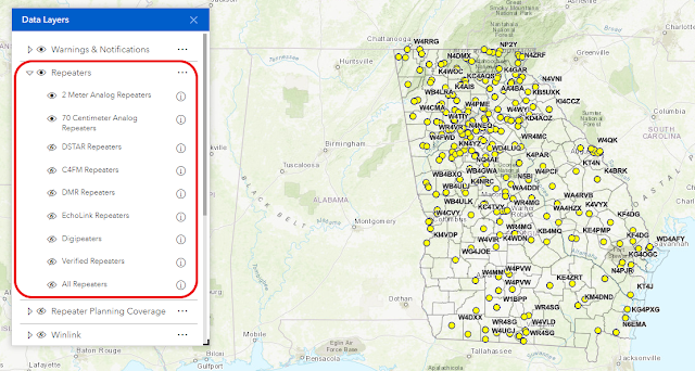
The single biggest change in this new map is in how these data layers are managed. In the old Situational Awareness map, all the data layers were in one very long and often confusing stack. It could be tough to find the data layer you wanted to turn on or off. This new map takes advantage of the ability to create logical layer 'groups' - expandable and collapsible groupings of related map data. For example, the new Data Layers listing now groups all repeater data under a single expandable heading called Repeaters.


Most of the functionality that was in the old Situational Awareness Map has been included in this new map:

  • The ability to view the data attribute tables
  • The ability to conduct pre-formatted searches for repeaters by callsign, and search for street addresses and individual counties
  • The ability to identify points on the ground by latitude/longitude, street address, US National Grid and UTM coordinates
  • The ability to switch base maps
  • The ability to do basic linear and area measurements
  • The ability to share the map on social media
  • The ability to generate elevation profiles (a new feature not available in the old map)
There is some functionality that has not been ported over from the old map, at least not yet:
  • The ability to do markups (graphics) on the map
  • The ability to print from within the map
  • The ability to overlay custom grids
I'm confident this missing functionality will become available as ESRI updates the Experience Builder platform.

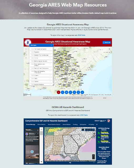
So, how do you find this new map? Simple! The new Situational Awareness Map is a component of the larger Georgia ARES Web Map Resources website. 


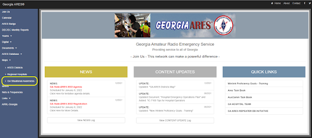
This website was launched in early 2021 and is linked from Georgia ARES website under the Maps pull-down listing on the left side of the page.


I'm scheduled to do a presentation on this new Situational Awareness Map at the 2022 Georgia ARES State Meeting scheduled for 8 January at the Georgia Public Safety Training Center in Forsyth, GA (COVID permitting). If you can't make this meeting, or want more information on this new map, or arrange a web-based presentation for your Amateur Radio or EMCOMM group, feel free to contact me at w8byh@arrl.net.

W8BYH out

20 September 2018

A Flurry of Development

A bunch of things have pulled me away from blogging over the past few months - some house repair issues, Army MARS training, my wife's knee replacement surgery (she's doing fine, thanks) and most recently, a flurry of development to bring our local ARES (Amateur Radio Emergency Service) group website into the modern age.

I got ambushed on this one. A few weeks ago I got an email from our county ARES emergency coordinator (EC) asking if I'd like to serve as the assistant emergency coordinator for digital activities. Since I can barely spell 'digital' I asked him what was up - why the sudden interest in digital stuff. After all, this ARES group has existed for decades blissfully ignorant of most digital mode operations and developments.

As it turns out, there's a new emphasis on the use of Winlink in the emergency communications community (EMCOMM). He wanted to get our ARES group up-to snuff on the basics of Winlink and how to use it to support a served agency. Since I had already given a few talks on Winlink, shamelessly stealing material from others to cobble together presentations, I guess he figured I knew what I was talking about.

I told the EC that I'd take the job, but from a digital perspective our ARES group has other issues that we need to address. First, we can't just stop at Winlink. We also need to get everyone up and running on Fldigi with some level of proficiency. Second, our ARES group web presence was... well, we really didn't have a web presence. We had an old website that held ARES info for our county and the adjoining county that we work very closely with, and we had an email reflector that had been run for almost 15 years on Yahoo Groups. Yeah I know, you're not the only one who's surprised Yahoo's still around.

The EC gave me carte blanche to get our web presence up to snuff, but it had to be done on the cheap. Real cheap, since our local ARES group has no budget. This meant free stuff, or as close to free as I could find. The first thing to tackle was the email reflector issue. Yahoo is one investor fire sale away from going under forever. That means its vast email reflector service is in danger of either going dark or, more likely, being folded into something like Google Groups. We needed to move off of Yahoo's increasingly ageing reflector technology and move to something more up-to-date. The reflector service offered by Groups.io was a natural choice, and a lot of Amateur Radio groups have moved to Groups.io over the past few years. In setting up our Groups.io account we made the decision to not migrate the old Yahoo Groups member list and content over to the new Groups.io environment. There were a lot of 'dead' email addresses in the Yahoo Groups account and we figured it was better to start with a clean slate and have currently interested members make the deliberate choice to sign up.

Next, I had to tackle the website and information portal issue. I do some web development for personal use, blogs, websites and the like, and I manage a good bit of commercial web development at work. I've got a good idea of the costs involved in website development, maintenance and hosting. Good web development isn't cheap, and cheap web development usually isn't very good. But again, our ARES group had zero budget - zip, nada - so I HAD to find something that wouldn't break the bank (ha, ha).

What I turned to was Google's G-Suite environment. G-Suite is Google's business focused upgrade to the free GMail/Google Docs environment. A single G-Suite account costs $60/year and includes features and capabilities not available in the free Google Docs environment. One of those features is Google Sites, a fast and easy website development environment designed for building lightweight internal work group and project websites. But with a few clicks of a button you can publish a Google Sites site on the public web. I use a personal G-Suite account to do web tool development for work so I was fairly confident that Google Sites could fit the need. The configuration options are few. You essentially have a single web template to develop against and you have very limited layout, graphics and text style options. You are also tightly locked into Google's ecosystem. If Google doesn't offer a function or feature it's not going to be available in Google Sites. But the trade off makes Google Sites ideal for our ARES needs - easy development, easy maintenance, fast performance, good integration with the Google Docs suite of tools (word processing, spreadsheet, photos) and dedicated data storage (Google Drive) that can serve as single information portal for all types of records.

Plus you can't beat the price. Really, you can't. Sixty bucks a year (that's $5/month) for use of an environment like this is dirt cheap when you consider all that it offers - website development and hosting, office automation tools, data storage. Since I'm already paying for my G-Suite environment I was able to provide use of this service free to Fayette ARES. All I had to do was go out and reserve a domain name to tie this new site to. After 10 days of development, testing, getting feedback, making changes and developing a how-to video, it's done.

So here it is: www.fayettegaares.org


Fayette ARES is now ready to be dragged into the 21st century! (Yes, I just said that 😄)


W8BYH out