- A design that emphasizes ruggedness, off road mobility, reliability and survivability
- Only a very minimum of 'bells and whistles'
- Powertrains optimized for rugged off-road performance
- A conscious selection of lower tech options (ex: coil spring suspension vs suspension air bags) to better fit the vehicle's mission requirements of reliability, mobility and survivability
- Virtually zero accommodation for 'lifestyle' options: entertainment systems, built-in wi-fi, seat-back entertainment systems, etc.
- An easily modifiable design
- A serious effort to keep the whole package reasonably affordable
15 July 2022
A Metaphor Of Sorts
10 July 2022
ARES Southeastern US Situational Awareness Map
This is a bit of a coming out party. So, noisemakers and party hats all around!
Last month I put up a post about the Situational Awareness Map, highlighting some changes I had made, and some future plans. Well I'm happy to announce that the map is now out of beta development and is available for general use. A lot of the changes are evolutionary, not revolutionary. But the changes and improvements are significant enough that a quick overview is warranted.
Perhaps the biggest change is that the map is now focused on the entire southeastern US, not just Georgia. I've talked with key users of this map for some time and the thought is that a regional focus makes more sense; weather systems and radio signals don't respect political boundaries, and we are often called on to support our fellow ARES members in adjacent states. But how do we define 'southeastern US'? Well, the most logical way is to follow FEMA, and use FEMA Region 4 as the definition. This makes a lot of sense since organizations like SHARES, DHS, CISA, NOAA, the Army Corps of Engineers and other federal agencies structure their disaster response frameworks in relation to FEMA regions. So FEMA Region 4 it is!
Other key improvements come in how the map (data) layers are structured in the map. Data structure is tightly focused around individual states. This give each state the ability to focus/display only the data pertinent to their states. There is a lot of regional/national data in the map, but that's only for map layers that by design must span the region. The best example is NOAA weather radar. This is a national-level data feed and it is impossible to segregate it out by state.
Another serious issue that is starting to push to the forefront is map performance. At this time there are over 45 separate data layers in the map, everything from severe thunderstorm warning polygons to PSAP 911 service areas. Every data layer, even if it's turned off, imposes a performance penalty in the map. Let's use the HIFLD fire/EMS station dataset as an example. This is a national-level dataset with tens of thousands of point (station locations). Before the map can display just fire stations in state of Florida it must first pull across the entire dataset, apply a dynamic filter against the data to select just fire stations that fall inside of Florida, apply a complex symbology rule against those points and then dynamically display them in the map so the fire station symbols remain the same size regardless of the zoom level the user selects. That's a lot of work to ask a web browser to handle. Multiply this one example by 45 or so data layers and you start to understand why map performance is an issue that must be carefully managed. This map is starting to push the performance limits of what Chrome, Firefox and Edge can reasonably handle. For that reason I've imposed some rules that users need to be aware of:
- With the exception of the Severe Thunderstorm Warning and Tornado Warning polygons (provided by NOAA) all other data in the map is turned off by default. When the map opens, it opens to a blank screen that shows just the state and county outlines. It's up to the individual user to tailor the map to his/her needs by turning on the data layers they want. Therefore it's very important that you review the available map layers and practice turning layers on/off
- Requests to add new data layers will require some serious justification from the requester. You will have to provide a compelling operational need for the data layer you are requesting. Remember, every data layer imposes a performance penalty. During real-world events like hurricane disaster response I'll add whatever data is needed without too many questions, but for non-operational use I'll have to be very selective about what gets added
- Data layers that don't get used will get dropped. I can track individual data layer requests, and if I see a particular data layer just isn't getting used, especially if it's a national or regional layer, it'll get deleted from the map
W8BYH out
08 July 2022
If The Big One Hits, Be In Syracuse!
Last month the Antique Wireless Museum released a 1951-era industrial movie made by General Electric that highlights how the city of Syracuse, NY used mobile radio for disaster response after a nuclear strike. Conveniently, General Electric's mobile radio division was headquartered in Syracuse, so this is really an early version of an infomercial. But it's a well done infomercial, and actually tells a useful story about how to create what we call today an emergency operations center, or EOC.
I'm surprised at how little has changed in terms of EOC operations between 1951 and today. Today we have fancier communications systems, software, computers, the internet, smartphones, and better looking firefighter helmets 😄, but most of the basic roles and functions we have in an EOC today were there in 1951. From that perspective the movie is quite interesting.
What I particularly liked was the use of an early 'GIS' (geographical information system) - a map table with push-pins around which all coordinating activity revolved. Today we have fancy computer-based GIS systems, but paper maps and pushpins are still in wide use. It's still a very effective way to maintain situational awareness.
I was also really struck by the emphasis the movie places on Amateur Radio as an integral part of any emergency communications system, and an integral part of EOC operations. Quite impressive, really.
So have a seat, strap on your way-back goggles, and enjoy EOC operations as they were over 70 years ago!
W8BYH out
07 July 2022
Something Interesting From Yaesu
Everyone else is jumping on the prognostication bandwagon, so why not me?
Yesterday the word came out that Yaesu is releasing a new HF rig in August. Called the FT-710, it appears to be about the size of the Yaesu FT-991A, but it's HF only (no UHF/VHF capability). Now, the 991A is no diminutive little mobile rig, and the 710, based on the announced specs, is actually just a smidge bigger all around, so this isn't a SOTA rig by any measure. Some have observed that this is likely Yaesu's newest 'entry level' SDR rig, and is likely designed to go head to head with the Icom IC-7300. That sounds about right to me, because the radio incorporates Yaesu's newest SDR technology (which is getting great reviews). What little we know of the feature set so far looks good:- High resolution touchscreen interface
- Build-in tuner
- A DVI port on the back (for out-boarding the digital interface)
- Two USB ports.
- SD card slot
What's NOT been released yet is any mention of a built-in soundcard interface. However, Yaesu makes mention of a 'Preset' mode for things like FT8, and since you need a soundcard to run FT8 I'm guessing the soundcard interface is there.
The things I don't see but would like, beyond the soundcard interface, are:
- Built-in GPS, and a GPS synched internal clock
- Some level of industry standard environmental protection such as IPX5
- A set of factory rack handles (a-la the IC-7200) would be nice, but if not I'm sure Portable Zero will be right along with a set
- Yaesu traditionally 'gets it' when it comes to back-lit buttons (Icom? Icom? Icom?). Let's see if they continue the tradition
04 July 2022
Chip Shortages - Still?!
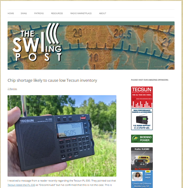
Thomas Witherspoon posted this a few days ago on his (excellent) SWLing Post blog:
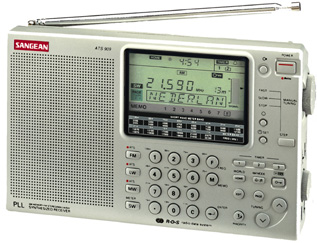
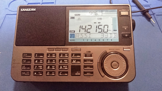
Based on reviews of the radio in publications like Passport to World Band Radio (sadly out of print, and badly missed), I picked up an ATS-909 just before heading back to Germany in 1998 for my second tour of duty there. At the time Central Europe was still a 'shortwave rich' environment, with powerhouse broadcasters like Voice of Russia (the old Radio Moscow), Deutsche Welle, and the BBC still pumping out content on shortwave. Additionally, I knew that many of the German FM broadcasters were switching to RDS, making the ATS-909's RDS decode capability a neat and useful feature.
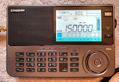
Reviewers really liked the improvements in the 909X2, but production was slow and prices for the radio, if you could find one, were high, with some retailers asking over $500. In the past six months production has increased, and the radio's price has settled down to about the $250 US level. Amazon now has regular stock of the radio and can deliver in a day or two.
One thing became abundantly clear to me in the few hours I've used this radio so far - the ergonomics and build quality are outstanding. Anyone who's spent any time with a portable SW receiver will find the controls clearly marked and well laid out. You don't need a manual to get up and running with this radio (but if you do, the manual is excellent).
Sangean includes an external wire antenna, ear buds, and something few other manufacturers provide - a 'wall wart' power cube. The radio runs off of four AA batteries and can use alkaline, NiMH and NiCad chemistry types.
A word about external antennas. Many manufacturers, including Sangean, include an external antenna with their radios. Many folks feel that a portable radio shouldn't need an external antenna. For commercial FM and AM broadcast reception, I agree. But for shortwave and ham radio reception, an external long wire antenna is absolutely necessary. You wouldn't expect your expensive Amateur Radio HF rig to operate well on 80 meters using a 3' whip antenna. Why would you expect a consumer-grade receiver to do better? Be realistic. If you buy a portable SW/HF receiver also pick up (or make) an external antenna to use with it.


