
And I still use paper maps.
Computer-based GIS is a very vulnerable technology. Everything comes to the end user via a web browser (with a few exceptions, but they are minor). This implies internet access, power, and a working computer. When any one of those three goes away, your access to digital GIS maps goes away. Consider:
- Hurricane Maria - Puerto Rico
- Japan - the 2011 earthquake and subsequent tsunami
- Turkey - the February 6th earthquake along the Turkey - Syria border
- California - the 2019 Kincade wildfire
In each of these events, modern web mapping services were available. But power and internet outages meant these mapping services could not be accessed for days or weeks within the affected areas. Even after power and internet were restored, there were still limitations on available bandwidth. This meant limited access to web maps, even for first responders using prioritized networks.
Closer to home, my radio club has long supported the National Weather Service forecast office in Peachtree City, GA. Our job is to contact storm spotters via Amateur Radio. Many of these spotters live in remote parts of the state that have very vulnerable infrastructure. Power and internet outages are a feature of life in rural Georgia, and services will be out for hours or days. Prior to 2019 that wasn't too big of an issue. Most spotters who were Amateur Radio operators had battery back-up for their radios and could keep operating and submitting reports. At the NWS forecast office, state-level street atlases could be seen at all the forecaster workstations, and we always had one at the spotter station. They were all the same, the DeLorme Atlas & Gazetteer for Georgia. We also encouraged storm spotters to use the DeLorme atlas. This commonality was important. DeLorme overprints a grid on each map - a simple x, y grid that makes it easy to identify location. For example, a spotter might call in and say, "I'm at the intersection of Pine Road and Sandy Street in Eastman." We'd ask him if he had a DeLorme atlas and if he did, to give us his location by page number and grid box. That way we could easily and quickly identify his location. This only works if, a. everyone has an atlas and, b. everyone has the same atlas.
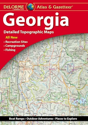
This post isn't an advertisement for DeLorme product. It's just what Georgia Skywarn adopted years ago. Other atlas products put out by companies like National Geographic or Benchmark can serve just as well. The important point is that everyone needs to be using the same atlas.
Around 2019, and with the arrival of COVID, how we support the forecast office changed. A lot more support is remote, and everyone started using NWS Chat to post spotter reports. But NWS Chat suffers from the same vulnerability web maps do - no power or internet, no NWS Chat. We can still communicate and take reports via Amateur Radio, but without a map it's difficult to visualize where the incidents occurred and start connecting the dots.
When the internet isn't available (for any reason) it's back to paper maps. While paper maps and atlases are a back-up to on-line web maps, they are a critical back-up. In ARES and Skywarn we should be standardizing the paper-based map tools we use as back-ups, and focusing some training activities around the assumption that all power and internet is out, and paper maps are all we have available. Remember, only one end of the radio conversation needs to be without power or internet for both operators to have to revert to paper maps.
So take it from this GIS guy - at some point Mother Nature will have her way, and either you or the spotter at the other end of the radio link (or both) will be operating in the dark, with a flashlight, using a car battery to power your rig. You're going to be glad to have that paper map.
W8BYH out
Another excellent, relevant, "spot on" blog post Brian. 100% agree. 73, KI4ASK
ReplyDelete